Mappe: quelle della biblioteca di Harvard sono fantastiche

Pubblicato il 5 Aprile 2017 alle 12:12 Autore: Guglielmo Sano
mappe, mappe storiche, mappe economia

Mappe: Le mappe della biblioteca di Harvard sono fantastiche

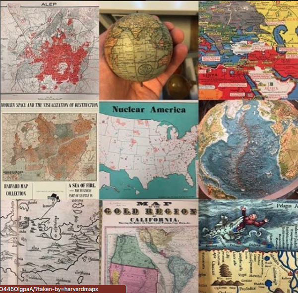
La biblioteca dell’università di Harvard possiede una delle più grandi collezioni di mappe al mondo, con oltre 500mila pezzi. Molti esemplari possono essere ammirati sul sito del rinomato college. Molti altri sono disponibili sul profilo Instagram della biblioteca. Spesso vengono pubblicati in concomitanza con date particolari e anniversari.

Mappe: quelle della biblioteca di Harvard sono fantastiche

La mappa riportata sotto, per esempio, è stata pubblicata a San Valentino. In essa si mostra la strada per giungere, evitando le “tentazioni”, alla città della beatitudine (coniugale).

We’ve got some serious #lovefromthearchives for you this week: a vintage #Valentine postcard complete with a sassy note! “Cupid’s Railway Map” features a love poem with a map to illustrate how single people end up in matrimonial happiness. Postmarked on February 14, 1911, the sender says, “I am at Bachelor Station, any inducements to move to City of Bliss.” We hope she said yes, because anyone who combines #maps and #romance must be a winner! This gem is part of our Siegfried Feller cartographic postcard collection. ********************* Fun fact: the publisher of this card, Ernest Nister, was well known for his #chromolithographed cards and books, and is believed to have been the inventor of the automatic #pop-up book. #loveletters #valentinesday #cupid #vintage #fromthestacks #iglibraries

Un post condiviso da Harvard Map Collection (@harvardmaps) in data:

Nel post sottostante, invece, una mappa animata che descrive i nuovi confini ungheresi dopo la prima guerra mondiale.

This #postcard animates the new borders for Hungary after World War I. With the dissolution of the Austro-Hungarian Empire, the new borders of Hungary did not include much of the land, and many of the Magyars, that had made up the Kingdom of Hungary for centuries beforehand. This postcard from 1920 laments this new political order. We have two (!!) copies of this postcard, one in Hungarian and one in English and German. As you can see here, the title is on a paste-down in German. On the back of the postcard, it carries the English title: “Hungary, Undivided One Thousand Years, Has Lost” after which it repeats the figures from the front. It was published by the Hungarian Women’s National Association. #moveablemonday #map #thematicmapping #wwi #hungary

Un post condiviso da Harvard Map Collection (@harvardmaps) in data:

Questa, invece, è una mappa multistrato risalente al 1936 che mostra le province dell’Impero italiano nel Corno d’Africa.

Questa mappa “a rullo” tratteggia tutto il corso del Mississippi.

Ecco come si faceva prima della GIF. Questa mappa “a scatti” riproduce l’andamento della Battaglia di Minden durante la Guerra dei Sette Anni.

Before GIS, we had literal map layers! Captain William Roy surveyed and drew this large “Plan of the Battle of Thonhausen” (aka the Battle of Minden) that Britain fought against the French on 1 August 1759. Engraved and published by Thomas Major on 29 February 1760, this map depicts one of Britain’s many victories in 1759 as part of the Seven Years’ War. The plan shows troop movement between 14 July and 2 August 1759 (notably with North pointing to the lower right). This section, in particular, illuminates the French camp’s movement against troops of the British, Hanoverian, and Hessian armies. The map itself forms part of our original, founding gift of Christophe Ebeling’s maps purchased and donated by Israel Thorndike in 1818. It is also one of over 100 maps of battle plans that only have card catalog records. #cardcatalog #maps #ebeling #thorndike #battle #gis

Un post condiviso da Harvard Map Collection (@harvardmaps) in data:

L'autore: Guglielmo Sano

Nato nel 1989 a Palermo, si laurea in Filosofia della conoscenza e della comunicazione per poi proseguire i suoi studi in Scienze filosofiche a Bologna. Giornalista pubblicista dal 2018 (Odg Sicilia), si occupa principalmente di politica e attualità
Tutti gli articoli di Guglielmo Sano →